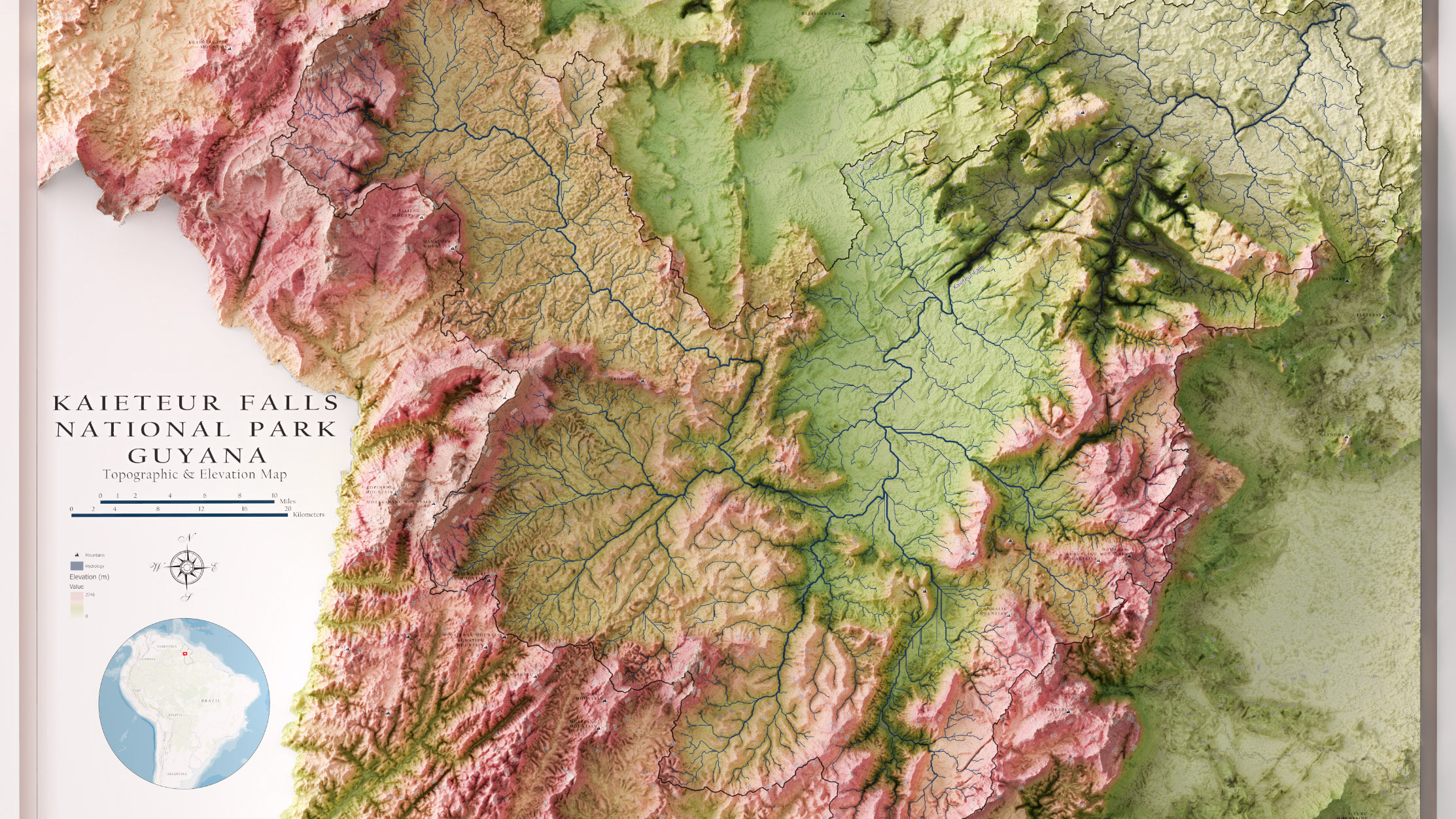
Currently I am working on completely maps in a similar style to this for many of the National Parks in America such as Grand Teton and Glacier National Parks.
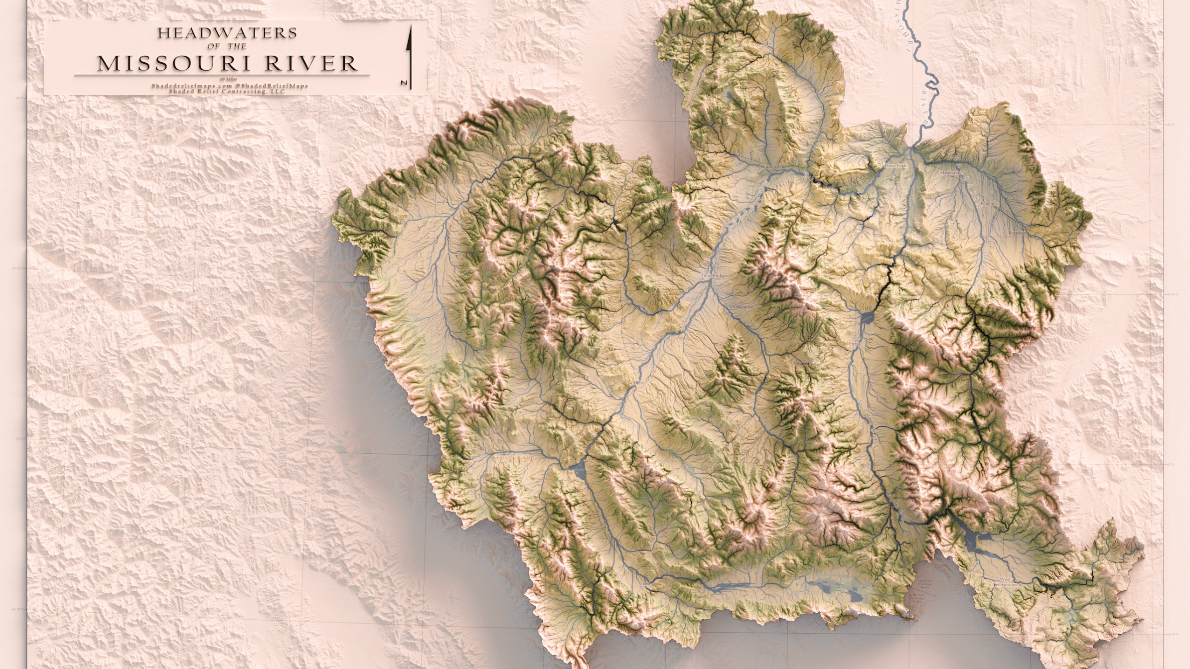
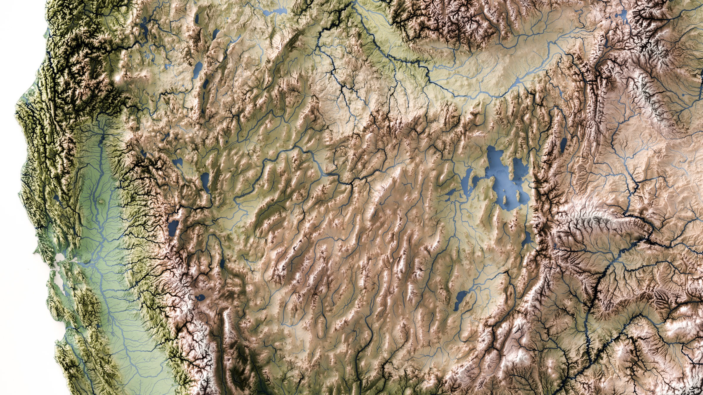
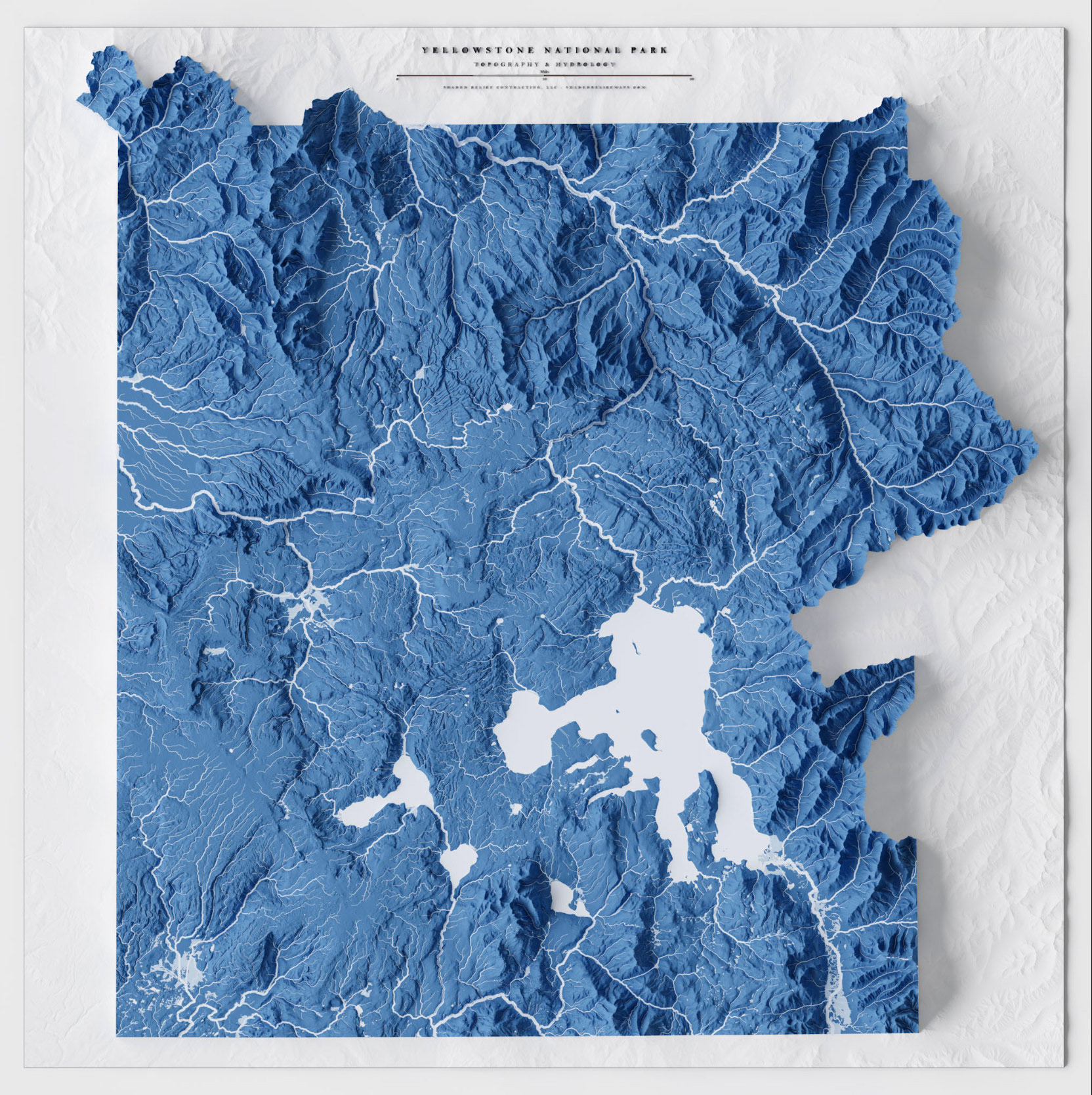
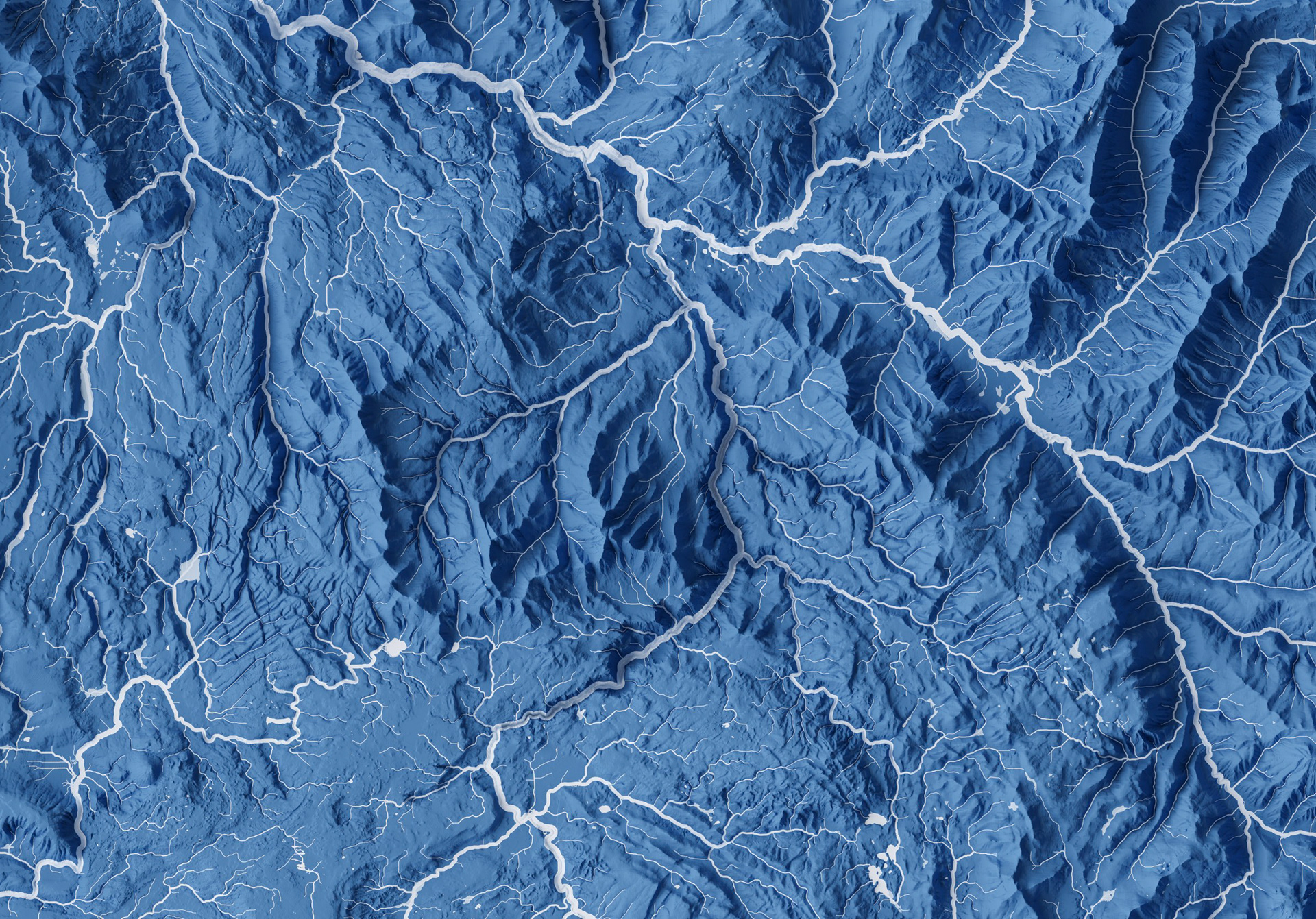
I used blender and spatial analysis tools to create a detailed hydrolographic map of Yellowstone National Park. By not including any data other than shaded relief and stream features, symbolized using strahler stream order, the map offers a unique view of Yellowstone that focuses purely on hydrography.