In 2021 I became interested with the unique topography of the Red Planet. Mars is dotted with interesting terrain, from the solar system's largest canyon, Valles Marineres - a valley nearly the size of the United States, to the tallest mountain - Olympus Mons, a volcano so high that the peak lies outside of the planet's atmosphere.
Upon closer examination, the landscape becomes even more fascinating. There are massive valleys scattering the planet that appear to be scoured by water, but at a massive scale. Amongst the craters on surface of the planet are sandbars, cataracts and fluvial channels carved out by ancient flooding events that have completely transformed the landscape. These features are not only distinct, but scales of magnitude larger than similar land forms seen on Earth. It is hypothesized that floods were the result of geologic activity that warmed, pressurized and released torrents of once frozen groundwater beneath the planet's surface.
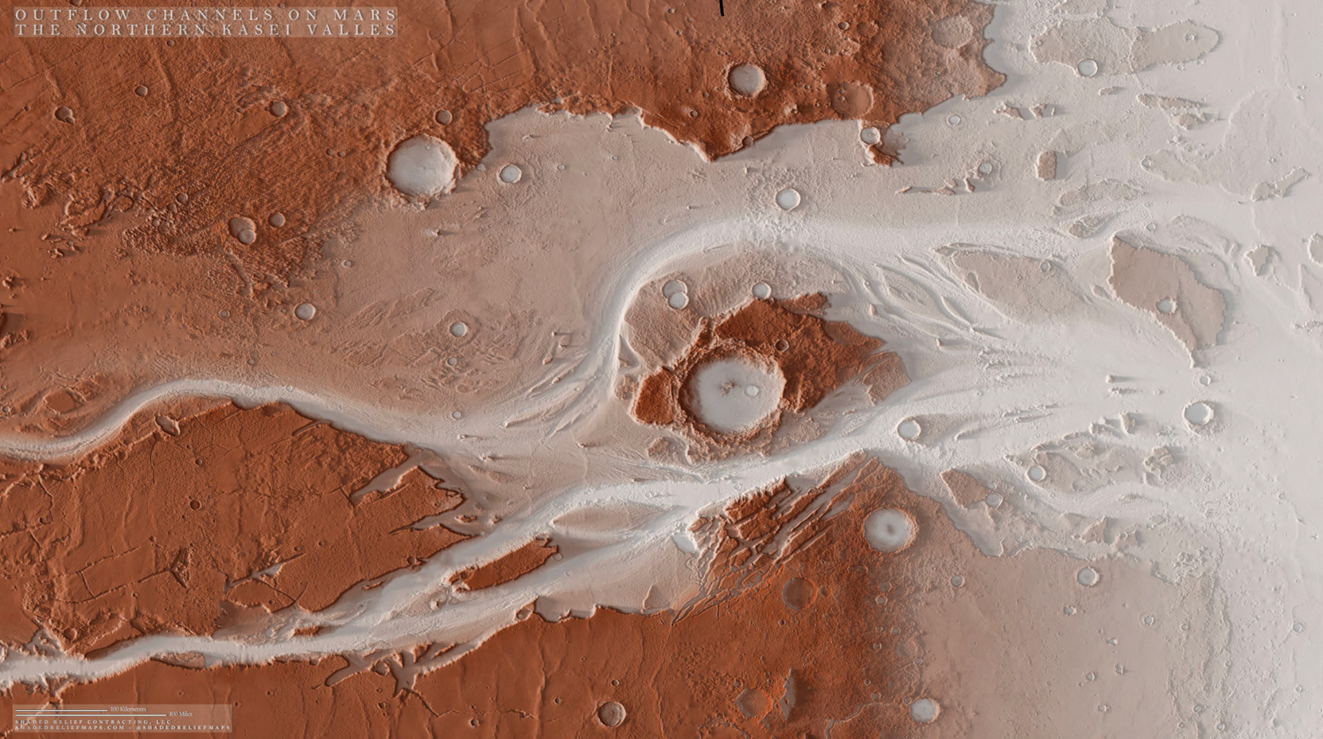
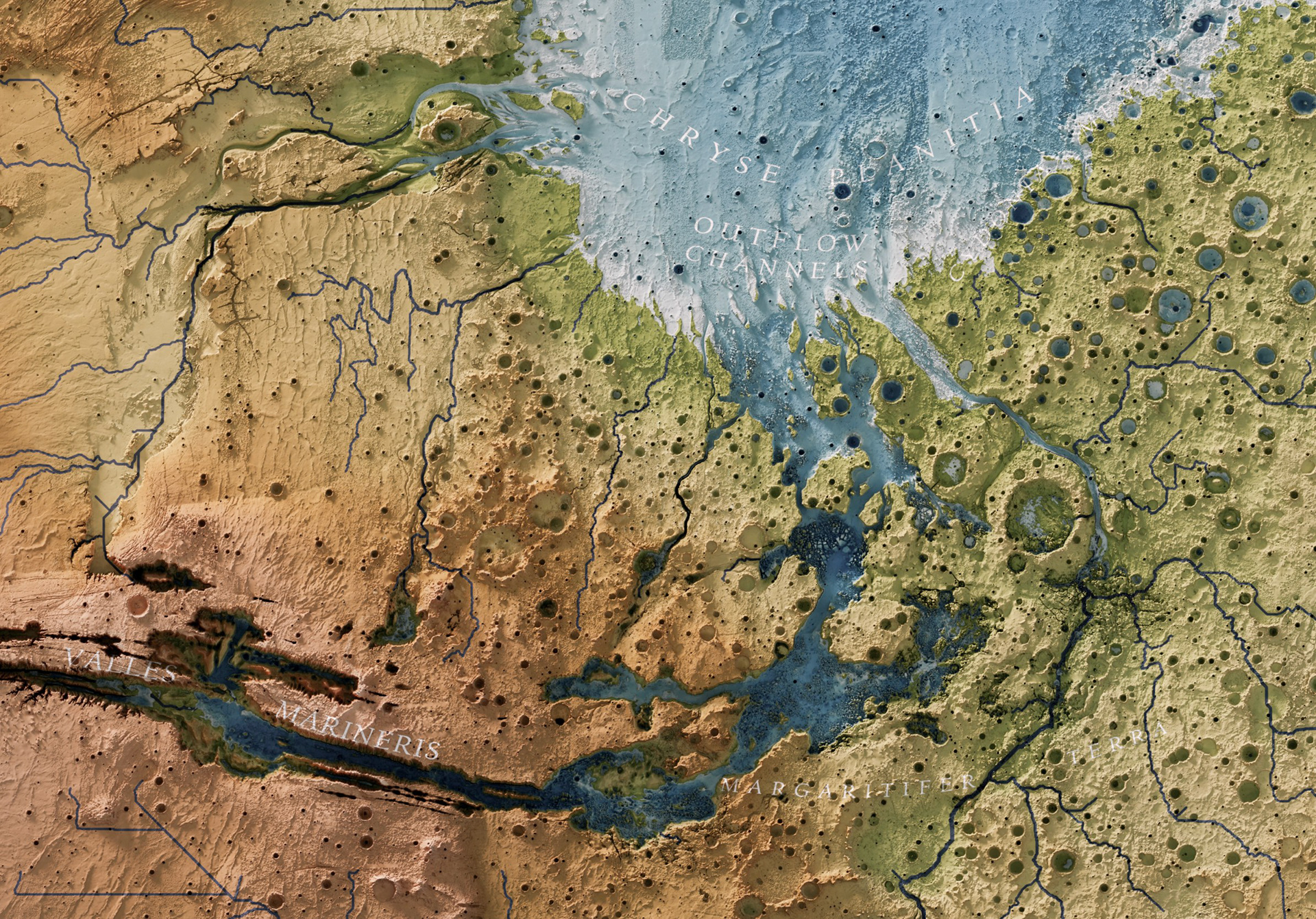
Above is a terrain map I produced of the outflow channels at the mouth of Kasei Valles. There you can see divergent flow pathways and erosional/depositional land forms from the planet's largest outflow channel. I used methodology outlined by cartographers such as Daniel Coe on relative elevation models, in conjunction with the 3D terrain visualizations of blender, to produce the visualization. By using relative elevation models and blender, I was able to select out lower lying elevations and highlight the flow pathways in an abstract but intuitively understood fashion. The basemap is a mix of hyspometric tints for the full relief of the region and targeted elevations where channels may have been present, in addition to blending in imagery collected by the Mars Viking satellite, which had imaged the planet's surface decades ago. I consider the map to still be a draft, as additional work can be done to clip the elevation data to select sections of the valley and delta like features .
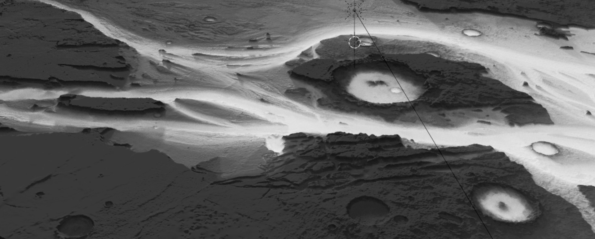
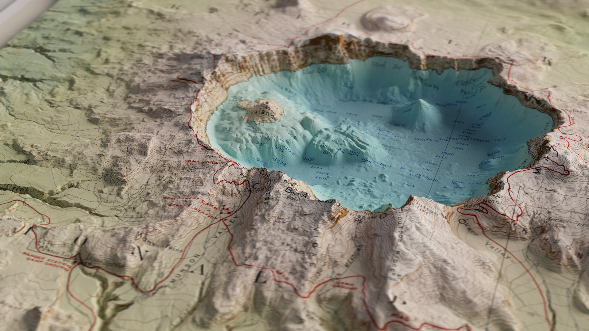
An oblique view of a section of the valley to showcase the dramatic terrain.
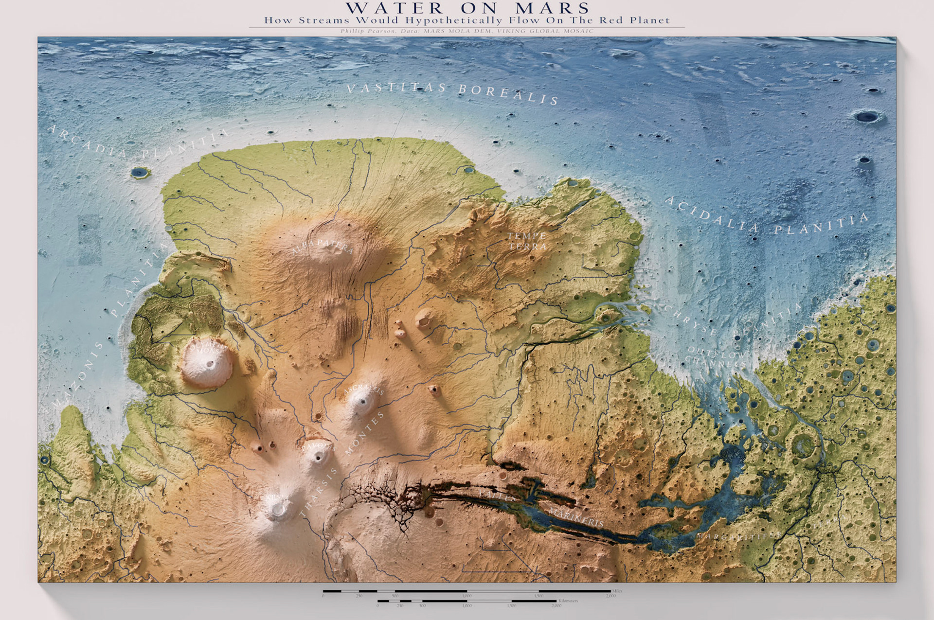
Prior to developing a stream meander visualization for the Kasei Valles, I worked to create an ambitious hydrologic model of the entire planet's surface. This visualization was playful, but clearly flawed. Many of the tools used to generate stream features worked, but made assumptions about the landscape that can be made on Earth, yet do not apply to Mars. One of these assumptions was the "Fill" hydrologic tool, which assumes that if a flow path finds itself in a sink, that the correct action would be to fill the sink until the flow path continues down slope. While accurate on earth, Mars's terrain has changed since these ancient floods have occurred due to geologic activity. This ultimately resulted in flow paths that never meaningfully terminated, as there were no definite water bodies to account for.
Despite this, the hydrologic model still provides insights where some flow paths may have occurred. If I was to revisit the project, I may remove sections of terrain prior to the analysis where slope is nearly flat, or on some geologic substrates, and conduct the stream pathways on a basin-by-basin approach. At some point I would like to return to the project and animate what an increasing/decreasing ocean level would appear like. It has been largely hypothesized that there were prehistoric oceans on the planet. When creating this project, I noticed that land forms similar to deltas did not have consistent elevations at which they occurred, leading me to believe the level of this hypothetical ocean may have fluctuated greatly, or maybe never existed entirely and are a result of a sudden change from high vertical relief to plains.
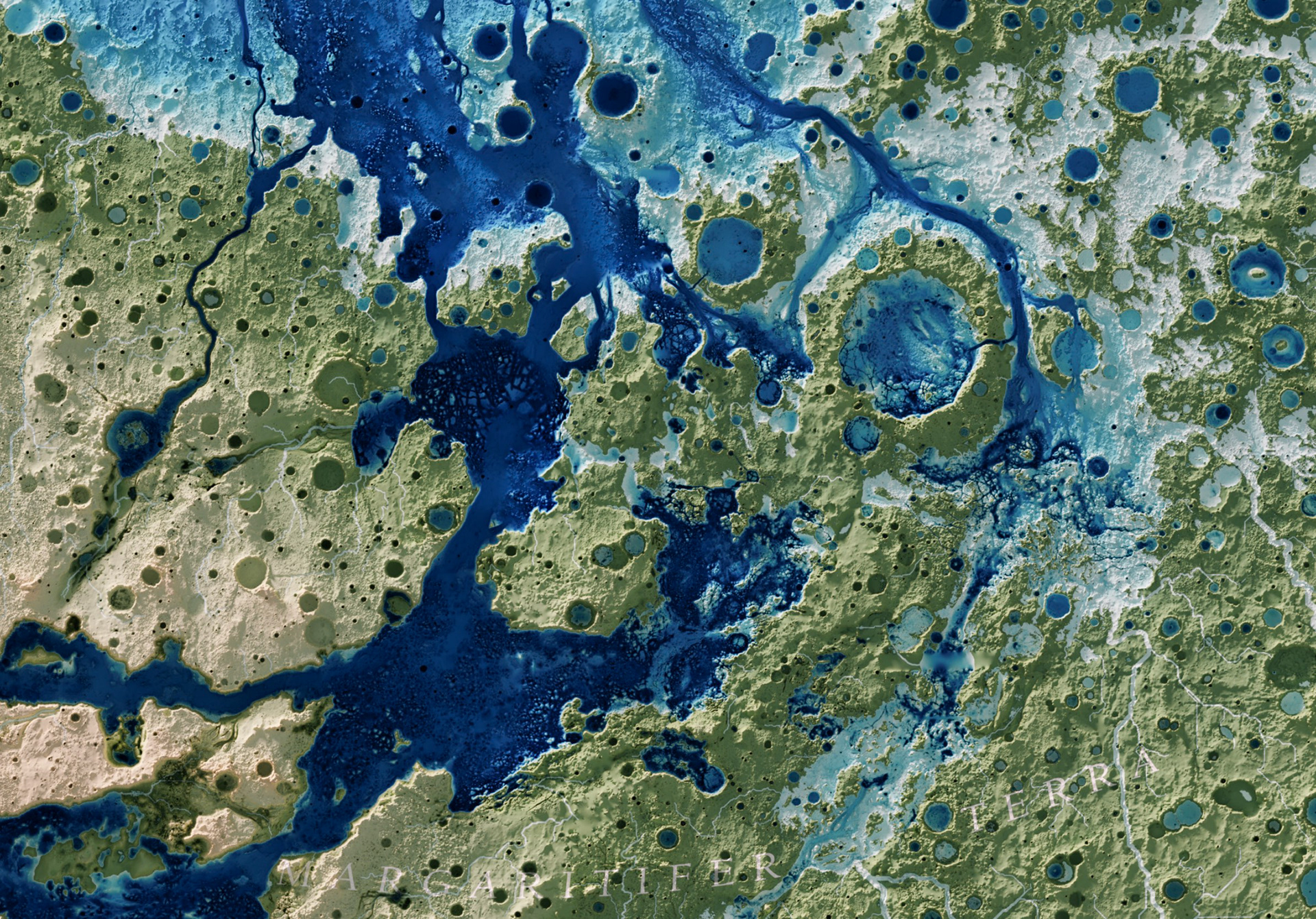
Still, the visualization has provided many interesting observations one can make from viewing the map. In the detail view of the map above (a draft with a hypsometric tint that highlights more bathymetry in the lower elevations), there are plenty of fascinating landscape features. It is inherently imaginative, yet I believe there is an element of truth, the degree of which can be debated.
I am particularly drawn to the craters which rims appear to have been incised by water flows originating within the craters. Other craters down slope of the major channels appear partially eroded, mimicking what you might see on a stream table while experimenting with placing obstacles in the pathways of a channel. There are clear sinuous, braided channels in some areas, where others indicate converging flows from separate flooding events. There is a level of interconnections between these features that can be hypothetically linked.
I found too many errors in this speculative map, which ultimately pointed me towards favoring stream meander visualization methods as seen in the first images on this page. As it stands, this project is still a work in progress. I look forward to publishing the full map once I am satisfied with the end product.